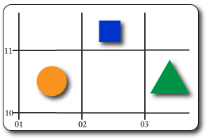
4-Figure Grid References
These provide a reference telling us which grid square the object is in.
Go along the bottom first & up the side second:
- (01,10) = orange circle
- (02,11) = blue square
- (03,10) = green triangle
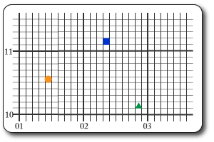
6-Figure Grid References
These provide more accurate location by specifying the exact location within a grid square.
As before, go along the bottom to get the square & then put how many tenths across it is (like a decimal point). Normally you will have to do this bit in your head as the only the numbered lines will be shown.
Repeat this on the verticle axis.
- (014,105) = orange circle
- (023,111) = blue square
- (038,101) = green triangle
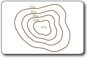
Contour Lines
These are the brown lines & they run along the sections of the map that are the same height. They are given a number which represents the height above sea level in meters. The closer together they are the steeper the gradient.
Spot Heights
These are the exact height of a point shown with a black dot & the height in meters next to it.
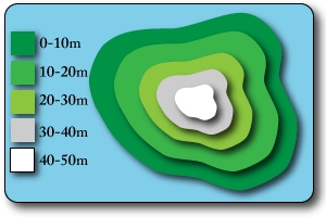
Layer Shading
This technique uses layes of different colours to represent height.
A key indicates the value of the colours.
If the colours change quickly it shows a steep slope.
It provides a very visual and easy to read display of the landscape.