Rivers

Study and revision resources

Placeholder image
Members area

Hydrological Cycle

  • Precipitation: water in falling to the earths surface (rain, hail, sleet, snow).
  • Interception: precipitaion that does not reach the ground (on leaves etc).
  • Surface runoff: water flowing over the surface of the land (streams, rivers etc).
  • Infiltration: water soaking into the soil layer.
  • Throughflow: infiltrated water that moves through the soil layer towards the river/sea.
  • Groundwater: water stored in the rocks below the soil layers, aquifers exists here.
  • Groundwater flow: water slowly making its way towards the sea thorugh the rock layers.
Water cycle, hdrological cycle
Figure 2.21: The Water Cycle

Drainage Basin Characteristics

  • Source: start of the river ( there may be many).
  • Tributary: a smaller river that joins a larger one..
  • Confluence: the joining of a tributary to the larger channel..
  • Mouth: the end of the river, where it meets the sea.
  • Watershed: the outer limit of the drainage basin.
  • Drainage Basin: the total area drained by a river system.

Tasks

Make a simple sketch copy of Figure 2.21, label the different stages.

Drainage basin
Figure 2.22: Drainage Basin Characteristics

Erosion Processes

  • Hydraulic Action: pressure/force of the water loosening material & widening cracks in the river bank.
  • Abrasion: the scraping action of material being transported.
  • Attrition: the breaking of stones when they collide with other material.
  • Corrosion: the dissolving of rock (limestone etc) by acid in the water.
  • Erosion occurs more in the upper course than the lower course.
River erosion processes
Figure 2.23: Erosion Processes

Erosion near the Source

Tasks

Study Figure 2.25.

  1. Describe the shape and size of the bedload of the river.
  2. Which types of erosion are most likely to occur here and why?
  3. Which types of transportation are occuring and why?
River upper course
Figure 2.25: Uppercourse of a River

Transportation Processes

  • Traction: the rolling of stones & rocks. Usually larger rocks.
  • Saltation: stones/rocks bouncing. Usually smaller rocks due to the energy required.
  • Suspension: very small particles being carried along in the river current.
  • Solution: dissolved material (invisible).
  • Traction & saltation occur more in the upper sections of a river.
River transportation processes
Figure 2.24: Transportation Processes

Deposition

Deposition occurs when the river looses energy.

During periods of high discharge such after heavy rain or through winter seasons the river has the energy to carry/move larger particles, as the gradient flattens out or the river widens the heaviest material is often dropped.

Finer material is carried the furthest in the flow of the river, often deposited as the river meaders through floodplains or in delta sections.

Figure 2.25 shows material that was carried downstream during the rainy season in Costa Rica when the river level is much higher and the velocity much greater. When the rains abate the river discharge dropped and the river deposited large quantities of stones/boulders.

Braided channel
Figure 2.25: Deposited material

Upper & Middle Course Landforms
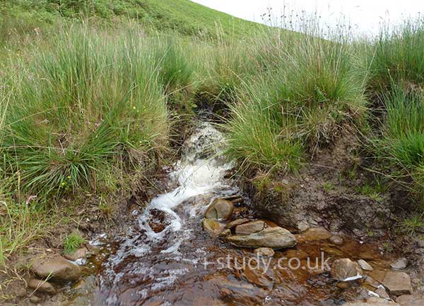
Waterfalls

  • Occur when rivers flow over layers of soft & hard rock.
  • The soft rock is eroded more easily, this leads to the hard rock being undercut.
  • A ledge of hard rock forms unitl it breaks and collapses into the plunge pool. Each time this happens the waterfall moves further upstream.
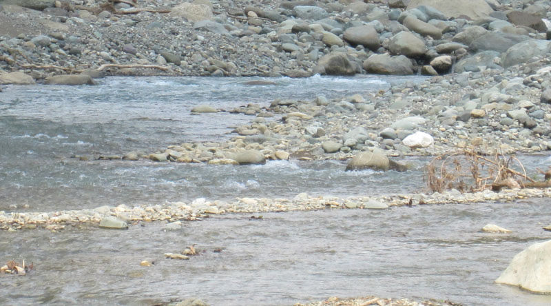
  • As the waterfall retreats upstream it often creates a gorge, see Figure 2.28.
  • Waterfalls occur in the upper and middle courses of rivers.

Tasks

  1. Draw your own digram of a waterfall and add labels that explain how waterfalls form and why they retreat back up the river.
  2. Describe the characteristics of the gorge shown in Figure 2.28
  3. Explain the features of the gorge shown in Figure 2.28
waterfall characteristics
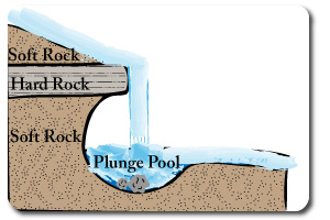
Figure 2.26: Waterfall Formation
waterfall
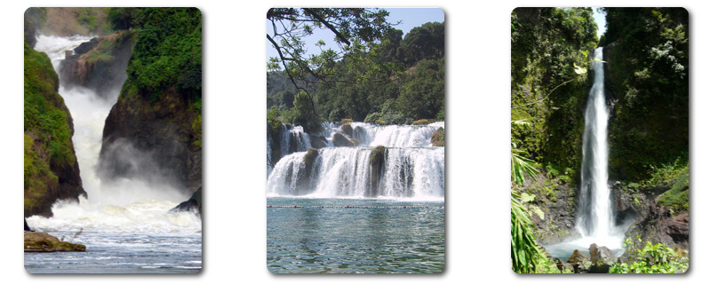
Figure 2.27: Waterfalls
waterfall
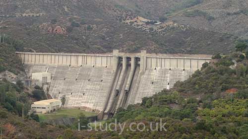
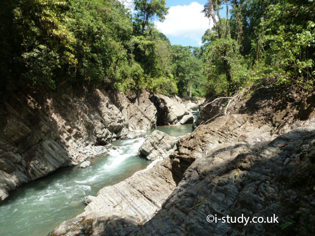
Figure 2.28: River Gorge

Lower Course Landforms

Floodplains and Meanders

These exist in the lower course of the river where deposition has occured. Repeated flooding deposits silt which builds up a flat fertile area -often used for agriculture.

Fast flowing water goes around the outside of river bends, eroding the river bank and widening the bend. The inside of bends have slow moving water which deposits material building up a slope/beach.

Conitnued erosion of meanders may result in the river short cutting through the bend to create a straight channel and leave an oxbow lake.

river cross section
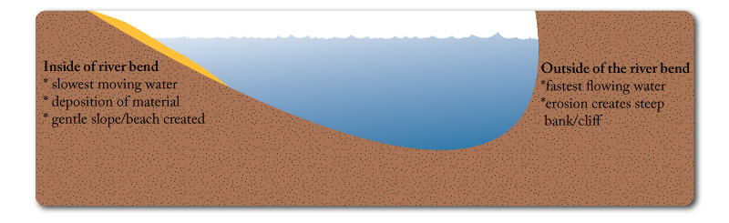
Figure 2.29: Cross-section of a Meander
River floodplain
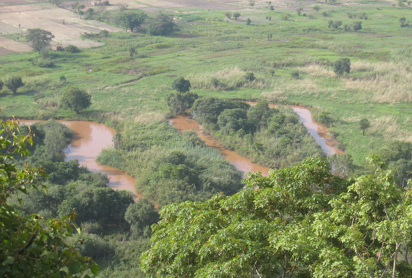
Figure 2.27: Meander through Floodplain
oxbow lake
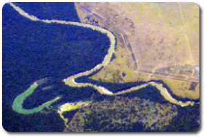
Figure 2.28: Oxbow Lake

Opportunities

Agriculture

Rivers bring fertile silt and soil to floodplains and deltas resulting in these areas are often being intensively farmed. Repeated flooding replenishes the nutrients taken by the plants. They also provide water for irrigating crops.

Trade

Many of the worlds most successful cities were built by rivers which provided freshwater and a way to dispose of waste. Importantly though they provide trade routes to other countries and continents.

Leisure

Rivers are increasingly used for leisure and recreation. Old industrial areas in MEDCs have been converted into appartments, art galleries, museums etc. Boating, rowing, swimming etc are common in cleaner rivers.

Energy

Rivers have been used a s source of power for mills and factory machinery for hundreds of years. Modern technology allows large scale electricity production form large dams such as the 3 Gorges Damn in China.

Trade on river Thames
Figure 2.31: Trade & Transport, Thames, London
Leisure on on River Thames
Figure 2.32: Rowing on the Thames, London

Multi-purpose Dams

Large scale dams such as the 3 Gorges Dam in China on the Yangtze river have been built to reduce flooding and generate electricity. In times of heavy rain the dam holds back flood waters and then releases it slowly to avoid damage downstream.

Storm Drains and Flood Channels

Urban areas at risk from river flooding often have large concrete channels built that allow rivers to quickly flow in a straight line. This gets the floodwater to the sea rapidly. Figure 2.34 shows one in Malaga, Spain - used for sport and even weekend markets during the summer months when there is very little rain.

Afforestation

Planting trees in upland areas increases interception of rain, absorbs throughflow and reduces soil erosion. This helps slow the amount of water reaching rivers and the speed with which it enters the main channel.

River dam
Figure 2.33: Dam for freshwater and HEP
Storm drain through malaga
Figure 2.34: Storm Drain through central Malaga, Spain

Hazards

Pakistan Floods 2010

Flooding is the most obvious and devastating hazard of living close to rivers. Pakistan experienced severe flooding in 2010 that displaced millions of people.

Tasks

  1. Watch Video 2.31 and use these links: Interactive map, about news.
  2. Identify the main physical and human causes of the floods
  3. Describe the main effects of the floods (people, economy, food supplies).
  4. Use this article to describe some of the methods being used to reduce the impact of future floods.
Video 2.31: Flooding in Pakistan, 2010

Revision Guides